Criss-crossing the heights of Lake Tahoe

The Sierra Nevada is criss-crossed with trails once used by the Indians, and Lake Tahoe is no exception, making it a delight for hikers of all abilities. So if you want to get away from it all, you'll have to get to the higher ground first.

You'll need to plan between 15 June and the end of September, if you don't want to have to deal with snow. For routes lasting more than a day, you'll need to take into account camping and the fact that the nights are cold. So you'll have to carry more, with the weight of your equipment added to that of your meals.

Although the effort required for short hikes is not comparable to that required to complete the Tahoe Rim Trail (10 to 15 days over 265 km), you will still need to be in good physical shape, as climbing with a heavy pack is not for everyone.

© Haveseen / 123RF

As with any adventure, success depends on preparation. It never hurts to be accompanied by an experienced hiker who knows the area. Bring a map from a reputable publisher. Staying in visual contact with the lake is a sure way of avoiding getting lost.

Here are some short walks designed to dazzle you with the beauty of the lake and the densely forested mountains that surround it.

The secret of a successful hike: a reliable, detailed map.

- © mladen mitrinovic / 123RF

Preparing and choosing your route

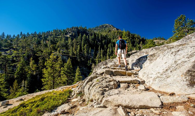
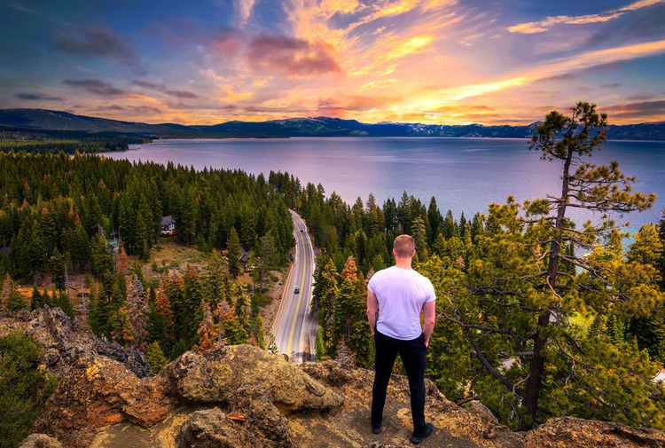
There are at least a dozen loops for a successful hike, somewhere around the lake. The best place to start is at acampground: Mount Rose campground, Marlette Peak campground, Luther Pass campground, etc.

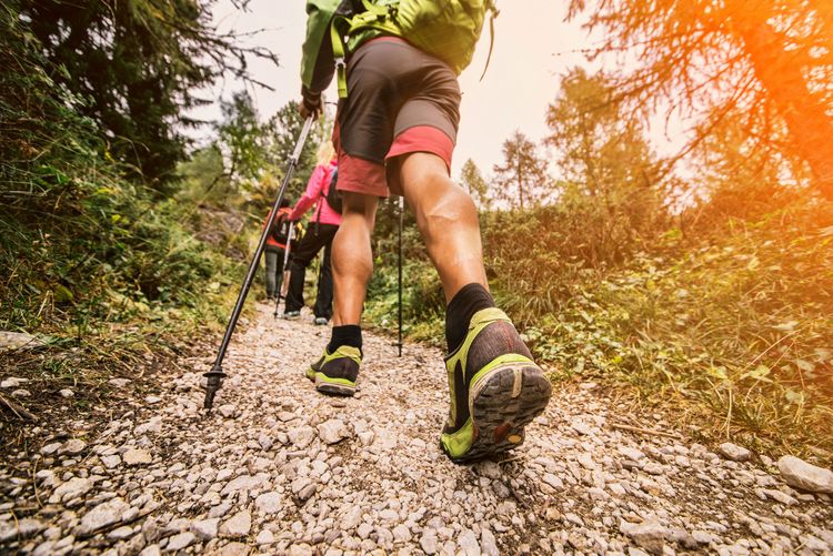
As far as preparation is concerned, you can simplify the task by opting for a short loop, which partly solves the question of food andwater. Buy airtight packets of prepared soup-like meals; they're nutritious and won't take up much space in your bag. The shopkeepers around the lake stock them, as you're not the only one who comes here for the hike.

Choose your starting point, taking into account your vehicle's garage. Obviously, you'll need to be well equipped for walking and camping.

In this chapter of the preparation, there is also the administrative question of authorisations, because the American State has its own rules (different from French rules), and is very particular. The rangers are on the lookout.

You will also need a permit to access the national parks if you are crossing one. You should also be aware that you won't be able to build a fire, or even light a small gas stove, without a "fire permit", which you can apply for online here:

Practical info

You will need

  • a thru-hiking permit
  • a permit to camp in the Desolation Wilderness.
  • You can apply for a fire permit at https://permit.preventwildfiresca.org/

To wit: bears

Bears live all over the Sierra Nevada and they have realised that the area around the lake, with its mass tourism, represents a larder within their reach. Although they do not generally attack humans (not to be confused with the Alaskan Kodiak), it is wise not to leave edible foodstuffs in your car, let alone in your tent, or even products that the bear could interpret as such: no cosmetic cream, suntan lotion, toothpaste, etc. There is nothing unpleasant about finding your tent crumpled. There's nothing irreparable about finding your tent crumpled, but your car... that's not so good!

So, if you want a good night's sleep, opt for the hermetically sealed sachets containing prepared meals; they come in the form of flexible water bottles, like the sachets astronauts take with them into space. Or the ones with compote for babies! Perfectly hermetic and perfectly opaque, they are of no interest to bears. And they're less heavy to carry than bearboxes.

Brown bears don't attack humans, but they do love their food.

- © Kristo Robert (kristo74) / 123RF

What you need to know: the weather

You are in a mountainous area, above 1900 m, and even in summer, the temperature rarely exceeds 15° in the morning. Nights are cool, even downright cold, which you should have anticipated by bringing warm clothes to sleep in and appropriate blankets and/or sleeping bags. Be aware that the weather can change easily and that there is a risk of storms. Violent winds are common in both summer and winter. You might as well be well covered up, as this will affect your ability to carry less necessary equipment.

The longer the trip, the more demanding the preparation.

- © Fabio Formaggio / 123RF

Practical info

For further information:

You can start your Tahoe Rim Trail hike in Tahoe City, Incline, South Lake Tahoe, Echo Lake or Kingsbury Grade.

The loops

Lake Tahoe Nevada State park

Let's start in this park with an easy hike that makes a 22 km loop around Spooner Lake, with a positive difference in altitude of just 60 m: Tahoe Rim Trailhead / Spooner Lake from Logan Creek Estates (starting from a car park).

There's also a nice hike to do in the area, between Spooner Lake and Marlette Lake. The Spooner Summit Trailhead will take you up to Spooner Lake, a lake on a smaller scale than its giant neighbour, but which still offers unspoilt, generous and invigorating nature. Here you'll camp, ride horses and do a lot of walking. It's a round trip (not a real loop) covering more than 16 km, which you can do on horseback if you feel like it, with an ascent of 535 metres. We particularly recommend it for bird-watching.

© Mirco1 / 123RF

Practical info

If your vehicle is not registered in Nevada, it will cost you $15 to enter the park. Otherwise, it will cost you $10.

For more information, click here.

Leaving from Emerald Bay

The Eagle Lake Trail is an out-and-back hike to Eagle Lake. It's a moderate hike that takes around an hour, more if you take the opportunity to discover this lake, which will never compete with Lake Tahoe. It is 3 km long and has a 140 m vertical drop. Many will be doing it to discover the Upper Eagle Falls, which are located right on the Eagle Creek that this hike follows. To get there, you'll have to climb a slightly steep staircase.

Eagle Lake in the Wilderness Desolation.

- © Jerrad Scoggins / Shutterstock

You will then enter the Desolation Wilderness. You'll need to obtain a Wilderness Permit at the Eagle Falls trailhead before entering.

We'd also recommend the Rubicon Trail, Eagle Falls, Angora Trail, Desolation Wilderness and other hikes. You can also go cycling or horse-riding on the renowned Truckee River Bike Trail.

by Editorial Team
Need a hand? take a look at our guide
Lake Tahoe
Lake Tahoe
Latest news
Edinburgh
Edinburgh to the rhythm of Scottish music
Edinburgh
Top 10 of Edinburgh's most beautiful hotels
Edinburgh
Visit the Rich Heritage of Scottish Art at the National Galleries of Scotland
Edinburgh
Into Edinburgh National Museum and its fascinating galleries
Edinburgh
Visit Greyfriars kirkyard, the world’s most haunted cemetery
Read more articles
Top destinations