The Anaga Forest is a biosphere reserve classified by UNESCO in 2015. It is one of the last primary forests in Europe, and is home to around 200 endemic species. This magical forest can be visited all year round and boasts breathtaking hiking trails and viewpoints.
The 3 most beautiful landscapes for hiking in Tenerife
The volcanic island of Tenerife abounds in sumptuous landscapes. From the dense, humid primary forests to the lunar and volcanic landscapes of the centre, and from the black beaches to the turquoise waves of the ocean, the beauty of this island is unique. Experienced hikers and Sunday walkers can enjoy superb panoramic views from fabulous walking trails. Whatever the scenery you want to see or the type of walk you're looking for, the Atlantic Ocean island has some unforgettable walks. We've chosen our favourite walking routes in 3 completely different landscapes: Anaga, the UNESCO Biosphere Reserve; the sheer, majestic cliffs of Los Gigantes; and the arid, lunar landscapes of the Tiède Volcanic Park. For families, sports enthusiasts or people with reduced mobility, Tenerife has the right hike for you.
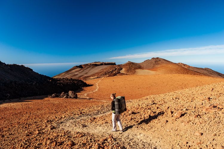
Les sentiers du parc Teide sont incroyables pour les randonneurs, Tenerife, îles Canaries, Espagne, Europe.
- Copyright © 2021 Baisa/ShutterstockHiking in the Anaga forest
 Tenerife
Booking.com
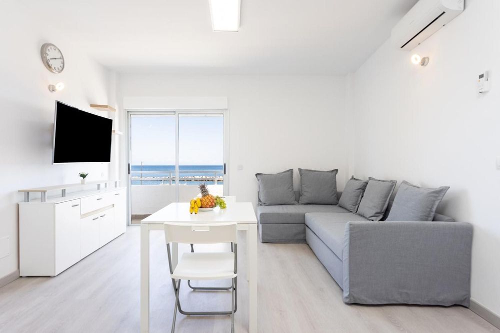
Home2Book Sea Front Las Teresitas Beach 1
This flat is just 300 metres from the beach and offers stunning sea views.
7.5
Fine
From
£288
/ night
Our 2 favourite walking routes
"El Sendero de los Sentidos", the path of the senses
This hiking trail was once part of the royal route that linked Anaga to La Laguna. It's an ideal trail for children, as it takes less than an hour to complete.
The trail starts at the Anaga Forest Visitor Centre in Cruz Del Carmen. The starting point is also a magnificent lookout point offering panoramic views of the island's highest peak, the Teide volcano.
There are 3 routes along the Path of the Senses:
Awaken your senses
This route is the simplest of the three. This wooden walkway is accessible to people with reduced mobility and families with young children.
Practical information
Length: 340 m
Difficulty: low
Height difference: 6 m
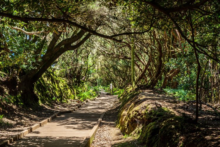
The paths of the senses in Anaga, Tenerife, Canary Islands, Spain, Europe.
- ©Valentyn Volkov/ShutterstockLet yourself be surprised
This short loop takes you over a bridge and a footbridge. You're on the old Las Montañas path.
Practical information
Length: 544 m
Difficulty: low
Difference in altitude: 20 m
Tenerife
✈️ Fly to Tenerife!
Compare prices and book your plane ticket to Tenerife!
From
£46
/ AR
What Monteverde has to offer
This hiking loop is the most complicated of the three. It gives access to the Llano de los Loros lookout point and also passes over a high footbridge.
Practical information
Length: 1,272 m
Difficulty: low-medium, some steep sections
Difference in altitude: 100 m
You can pick up free trail maps at the visitor centre. In general, the paths are very well signposted.
The hike from Benijo to El Draguillo
From the village of Benijo, set off along the moss and lichen paths of the Anaga rainforest towards the village of El Draguillo. This is a fairly popular loop, and we recommend arriving early to find spaces at the Benijo car park.
Practical information
For a crescendo of sublime views, take the path clockwise.
Find the route of the hike.
Length: 500 m
Difficulty: Intermediate
Difference in altitude: 473 m
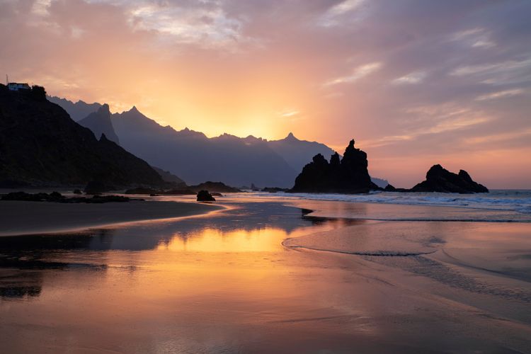
Benijo Beach, Tenerife, Canary Islands, Spain, Europe.
- ©Ana Iacob Photography/ShutterstockHiking in the cliffs of Los Gigantes
These cliffs, which measure between 300 and 600 metres, plunge into the Atlantic Ocean, offering some impressive scenery.
From the village of Masca to the beach
One of the most beautiful walks on Tenerife begins in the small village of Masca. Of Guanche origin, this village of 90 inhabitants is perched on the edge of a hill, in the middle of the mountains.
Park your car in the village and head down the path towards the coast. There, you arrive at Playa de Masca, facing the Atlantic Ocean and surrounded by the cliffs of Los Gigantes. The second part of the walk takes you back up to the village.
For this hike, you'll need to book access to cross the gorge known as the "Barranco de Masca", an area of astonishing geological shapes. This part of the island is regulated to protect both the environment and hikers.
Be warned: the climb back up is tough. We don't recommend it for everyone - only experienced hikers can embark on this adventure. Hiking boots are essential.
Practical information
There is not much parking at Masca, so try to get there early in the morning or on weekdays.
Length: 8,500 m
Difficulty: Difficult
Difference in altitude: 800 m
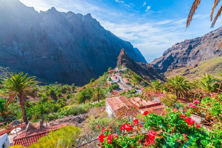
Le village de Masca, Tenerife, îles Canaries, Espagne, Europe.
- Copyright © 2018 Balate Dorin/Shutterstock. No use without permission.Teide Park walks
Volcan Teide Park boasts numerous trails for hiking enthusiasts.
 Tenerife
Booking.com
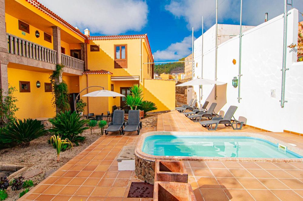
Hotel El Tejar & Spa
This small 2-star hotel offers attractive rooms with TV, private bathroom, bed linen and towels.
9.2
Fabulous
From
£75
/ night
Roques de Garcia trail, lunar landscapes and rock formations
There's no need to climb all the way to the Teide volcano for some great hiking. In a lunar-like landscape reminiscent of the "Valley of Fire" in the United States, this little loop at the foot of Teide is a real pleasure.
Starting from the car park at the La Ruelta lookout, take path number 3 to the Roque Cinchado, a rock formation less porous than the others, which stands proudly in the arid landscape as it resists erosion.
Practical information
Length: 4000 m
Difficulty: Easy
Difference in altitude: 157 m
Recommendations
This is a very sunny walk, so it's best to venture out in the mornings or evenings. Otherwise, don't forget to cover up and/or apply sun cream.
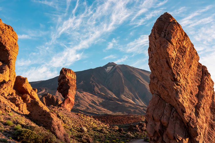
The lunar landscapes of Tenerife, Canary Islands, Spain, Europe.
- ©Christopher Moswitzer/ShutterstockTrekking the Chinyero volcano and its breathtaking views
The Chinyero volcano is the youngest volcano in the Teide Park. It nevertheless rises to a height of over 5,000 metres.
This hike takes you through lush forest and magnificent volcanic landscapes, all without difficulty. This loop is accessible to children and offers breathtaking scenery.
You can leave your car at the San José de los Llanos car park.
This walk can be done on foot or by mountain bike.
Find out more about the route.
Practical information
Length: 7000 m
Difficulty: Easy
Difference in altitude: 200 m
Latest news
Edinburgh
A literary weekend in Edinburgh
Edinburgh
Top 10 of Edinburgh's most beautiful hotels
Edinburgh
Visit the Rich Heritage of Scottish Art at the National Galleries of Scotland
Edinburgh
Into Edinburgh National Museum and its fascinating galleries
Edinburgh
Visit Greyfriars kirkyard, the world’s most haunted cemetery
Read more articles
Top destinations