The Grand Paradis Vanoise Nature Trek in 6 days

Trek Nature Grand Paradis Vanoise is a project funded by the European Union as part of the ALCOTRA cross-border cooperation programme. It aims to enhance the value of the two national parks, Vanoise and Grand Paradis, by making them more attractive to tourists. This 116 km hike, designed for experienced hikers, links five towns in the two national parks: Val d'Isère and Bonneval-sur-Arc in France, and Rhêmes-Notre-Dame, Valsavarenche and Cérésole Reale in Italy. This 6-stage loop, with 5 or 6 nights in mountain huts, takes hikers through the beauty of the Franco-Italian mountains. As with all treks, Grand Paradis Vanoise requires that you do not set off alone, that you check the weather every day and decide to stay in the refuge in case of bad weather, and of course that you have the right equipment. Mountain guides are also on hand to organise the trek and accompany you on each stage.

A hiker on a summit in the heart of the Parc de la Vanoise

- © Thierry de Villeroche / Shutterstock

Benevolo - Chivasso via Col Rosset 5h00 - 10.7km (+913m, - 610m)

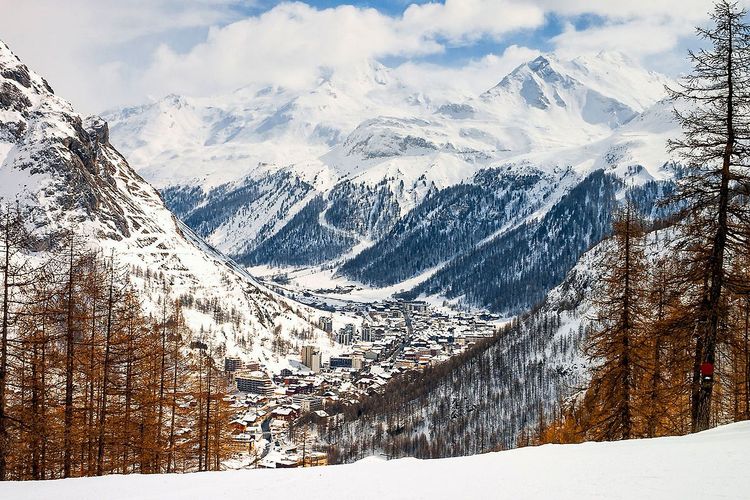
This stage starts from the Benovolo refuge. It takes 1? hours to reach the hut from the car park at the bottom of the Thumel Valley.

It is best to sleep the night before at the refuge.

https://rifugiobenevolo.com/fr/?utm_source=easyvoyage

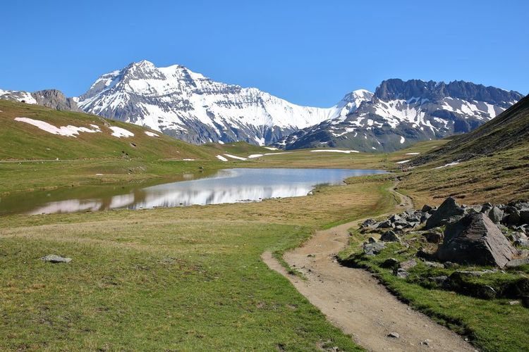
From the Benevolo hut, perched at an altitude of 2,285m, the hike begins towards the farmhouse and then joins the road that climbs to the left for around 500m until it comes to the first bend. This is where a sign indicates the start of trail no. 13A leading to Col Rosset. After a long traverse of the grassy slope dotted with a few streams, hikers arrive at a promontory at 2407m offering a breathtaking view of the Rhêmes valley and the Grande Vaudelaz valley.

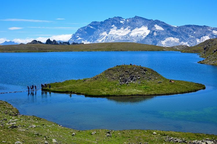
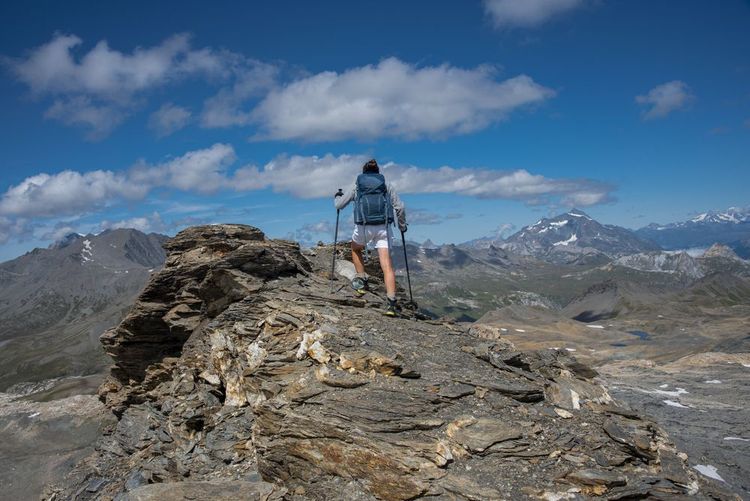
The second part of the route takes walkers to the river of the same name, opposite the Grande Vaudalaz mountain pasture farm at 2348m, which can be reached in 1 hour 15 minutes. After joining trail no. 12, hikers make their way through the alpine pastures. In this little-frequented valley, lucky hikers can spot a variety of animals, including marmots and chamois. The trail leads to a pretty little lake on the left, before arriving at the pink rocky notch of the Col Rosset, culminating at 3025m.

Lac du Rosset

- © FocusLuca / Shutterstock

The panorama offered to hikers is absolutely remarkable, with several majestic peaks, including the south face of Grand Paradis, which dominates the whole area. Below, numerous lakes stretch across the Rosset plateau. The descent begins with the first 150m, which are fairly steep and narrow, as far as the Chanavey lakes. From here, an easier path leads down to the valley floor. There is a final climb of around 150m between Lac Rosset and Lac Leita, at 2700m. The final approach to the Savoia (2532m) and Chivasso (2604m) refuges is via the plain of the Col du Nivolet.

A choice of two refuges to spend the night:

From the Chivasso/Savoia refuge to the Prariond refuge via the Col de la Lose 5h30 - 10km (+818m, -1088m)

From the Chivasso refuge, a winding path leads to the Agne pass. The route begins by crossing a tributary that flows into the magnificent Lac Agnel, offering breathtaking views. The trail then continues to a Second World War fort and begins a steep, winding descent. However, the descent softens diagonally as it passes behind the farm and a small fort before rejoining the main path towards the Col de la Lose. This variant offers panoramic views to the right of Lake Serrù, with the Capra glacier, the Cime d'Oin and the Cime de la Vache.

The long traverse around the lake leads to a rocky spur that can be climbed in two ways: either with fixed ropes, or by descending a few metres and then ascending a little further. A short cable traverse then leads to the Pian Ballota refuge. As soon as you leave the rocky area surrounding the refuge, the path continues over the roof. This section is equipped with fixed ropes and iron steps set into the rock. The slope that follows is fairly steep and runs alongside the waterfall of the Plan de la Ballota. To reach the plateau, you have to cross a final steep section equipped with steps and handrails. This section is undoubtedly the most complex and exposed, requiring extra care and attention.

After crossing the bridge over the stream and the alluvial plain, the path crosses a section of scree that rises towards the south. A boulder marks the right-hand bend towards the Col de la Lose. The path ends at the foot of a route of handrails and ladders, sometimes vertical and sometimes horizontal, which lasts at least half an hour. At the col, an orientation table allows you to admire the exceptional panorama over Grand Paradis. On the other side, the peaks in the foreground surround the Prariond valley, with the Grande Motte glacier in the background.

Grande Motte glacier

- © Christophe Cappelli / Shutterstock

The start of the descent is marked by an aerial steep slope leading to a lake, which you skirt to the right. The slope then becomes gentle and follows the edge of the cliff to large cairns, where a path crosses to the right towards the Col de la Galise. Marmots appear regularly on this green slope. In the last few hairpin bends, a beautiful gorge overlooks the Prariond refuge, 100m below.

Overnight at the Prariond refuge

From the Prariond refuge to the Fond des Fours refuge via Val d'Isère 5h - 15.4km (+829m, -691m)

Heading west, the hike takes you past numerous marmots along the Prariond valley. Once in the Malpasset gorges, the path becomes airy but safe, thanks to chains that make it easier for hikers to cross. Once out of the gorge, the winding path leads to the Pont Saint Charles car park (2050m), before crossing the bridge onto the D902 towards the Col de l'Iseran. After crossing the "Mangard" track, continue straight on through the Petit Bois forest, crossing the Sounières and Iseran streams in turn (2039m). This section offers a breathtaking view of the village of Le Fornet.

At elevation 1969m, hikers will take the downhill section of the nature trail as far as the bridge over the Leissieres stream to rejoin the GR5. Cross the lane in the hamlet of Laisinant and walk alongside the stone gabions to reach the crossroads with the chapel of Saint Jean (1842m). If you turn left, you should head due south towards Le Manchet, passing the sports facilities set up for the summer season.

At the end of this valley is the old, uninhabited hamlet of Le Manchet and the gateway to the Vanoise National Park. At the old hamlet of Le Manchet, the GR55 crosses the bridge and veers south-east down the valley, where you can stop off at the Arcelle farm (2131m). At 2200m, the path becomes more difficult over dense, sometimes rocky, high-altitude grass to the Fond des Fours refuge (2537m), where you can finally take a rest.

Overnight at the Fond des Fours refuge

From the Fours refuge to the Carro refuge via the Col des Fours 6h10 - 17.6km (+1257m, -1042m)

This stage begins with 500 metres of flat walking, the track leading to the meandering ruisseau des Fours, which rises in the Méan Martin glacier near the Col de la Rocheure. At the crossroads, take the path heading due east towards the Vallon des Fours. It takes around an hour to climb the path up to the col at an altitude of 2976m. The last 100 metres require a little more effort. From the top of the Col des Fours, the panorama of the Tarentaise mountains to the west and the Haute Maurienne to the east is breathtaking. On the left, the path overlooking the Lac du Grand Fond runs diagonally down to the pass. The path follows the ridge between L'ouille de la Jave on the right and Lac de la Jave on the left. 100 metres before reaching the Pont de la neige, turn south-east and follow the GR5, which overlooks the gorges of the ruisseau de la Lenta.

Once you reach "Le golaillon", at an altitude of 2,345 metres, climb back up to the D92 road. Cross the Pont de l'Ouilleta to join the Haute Maurienne GRdp. The path overlooks the alpine chalets and their herds of cattle grazing at 2100 metres altitude. The trail slopes slightly up to the Plan des Eaux at 2695 metres. It offers a magnificent balcony trail with views of the glaciers of the Haute Maurienne.

After 3.5 km, the trail heads north-east around the ouille des Reys to face the superb Montet waterfall. The slope then descends to the small bridge at 2603 metres altitude, below the charming little Lac du Pys. After more than 5 hours' walking, you can follow the sheep while discovering the border cirque that gives rise to the Arc river. To the left of the springs, the path climbs towards Plan Sec, the start of the final ascent to the Carro refuge. The path crosses the path that descends to the right towards the dry-stone hamlet of L'Ecot, which leads to the main town of Bonneval-sur-Arc.

Village of Bonneval-sur-Arc

- © Michel PERES / Shutterstock

Night at the Carro refuge

From the Carro refuge to the Chivasso/Savoia refuge via the Col du Carro 7h - 10.8km (+1047m, -1193m)

The route starts behind the refuge (2700m) heading north, with a path leading to a small lake (2850m). After the 3000m mark, the route turns left onto a gneiss massif with stable slabs, eventually leading to a pass surrounded by countless cairns. Levanna Orientale and Levanna Centrale stand out in the background. The descent from the col is steep and requires concentration, with a diagonal traverse requiring the use of fixed ropes.

The path marked out in red and white leads to a second aerial section, less difficult than the previous one. It then leads to the left, below the Col du Carro wall. The winding descent continues to the foot of the ridge overlooking the cliff below. A long moraine traverse crosses glacier run-off and névés. This leads to the junction with the glacier route coming from the left from the glacier below the pointe d'Oin.

Col du Carro with views of Serrù and Agnel lakes

- © FocusLuca / Shutterstock

After reaching Colle delle Rocce, with its breathtaking views of Lake Serrù, descend a steep, winding path alongside a pretty little lake. Then skirt around the Punta delle Rocce, offering views of the dam on Lake Serrù, before descending over rocky debris for around 30 minutes. After crossing the dam, the route continues on a tarmac road and then on a path leading to the Agnel pass. The climb to the pass is a steep, narrow and tortuous path, with rocky sections equipped with fixed ropes and an aerial section passing the side of a fort. Finally, the path joins the tarmac road below the Chivasso refuge.

A choice of two refuges to spend the night:

From the Chivasso/Savoia refuge to the Benevolo refuge via the Basei pass 6h - 12km (+867m, -1156m)

Heading straight down from the Chivasso refuge, a sign indicates the start of the route on the left. The path crosses the meadows and climbs towards the Rosset stream, leaving the fork on the right that leads to the alpine farm in the direction of Taou Blanc and Col Leynir. Crossing the stream, the path continues across the plateau, crossing the same stream again before forking left towards Col Basei, signposted before Lac Leytà.

The grassy, earthy path quickly twists and turns and climbs over a slightly aerial passage. After a section equipped with fixed ropes and some iron steps, the path leads to a flatter, rocky area. Continuing south-west, the path forms a semicircle without gaining altitude before passing a detrital area on rocky terrain marked by several cairns. This part of the path disappears before reaching the Basei pass, which is marked by an imposing pyramid.

After a narrow section, the path crosses a fairly wide ridge offering views of the Basei glacier. The traverse to the foot of the summit rock is easy even without snow. The trail ends after crossing the ridge. There is a fixed rope on the 15-metre-high wall to facilitate the ascent to the final ridge leading to the summit. The rocky crossing requires a minimum of attention. From the summit, the 360°C panorama is magnificent.

From the large cairn marking the pass, follow the cairns to the bottom of the valley and descend along a fairly steep gravel path. After walking 100 metres along the ridge, the path joins the clearly visible track on the moraine that leads down to the meadows. On the way, you pass over a sloping rock face before crossing the pastures inhabited by countless marmots. The path also passes over a gorge eroded by glacial waters before arriving at the Benevolo refuge.

You can choose to spend the night at the Benevolo hut or return to the car park, where the cars are parked but the last stage has to be extended by 1? hours.

© Trek Nature Grand Paradis Vanoise / Youtube

Practical information

👉 Guide offices

https://www.guidegranparadiso.com?utm_source=easyvoyage

https://www.guidevalgrisenche.com?utm_source=easyvoyage

👉 Official website of the Trek Nature Grand Paradis Vanoise :

https://trek-nature.com/?utm_source=easyvoyage

by Faustine PEREZ
Need a hand? take a look at our guide
Val d'Isère
Val d'Isère
Latest news
Edinburgh
Edinburgh to the rhythm of Scottish music
Edinburgh
Visit the Rich Heritage of Scottish Art at the National Galleries of Scotland
Edinburgh
Into Edinburgh National Museum and its fascinating galleries
Edinburgh
Visit Greyfriars kirkyard, the world’s most haunted cemetery
Edinburgh
Explore the Palace of Holyroodhouse
Read more articles
Best cities